Mamba Exploration
  • Home
  • Corporate
    • Board and Management
    • Corporate Directory
    • Corporate Governance
  • Projects
    • Projects – Canada
      • Canary Project
    • Projects – Western Australia
      • Darling Range Project
      • Calyerup Creek Project
      • Ashburton Project
      • Kimberley Project
  • Investors
    • Investor Dashboard
    • ASX Announcements
    • Reports
    • Presentations
    • Media
  • Contact
  • Click to open the search input field Click to open the search input field Search
  • Menu Menu

Black Lake South Project

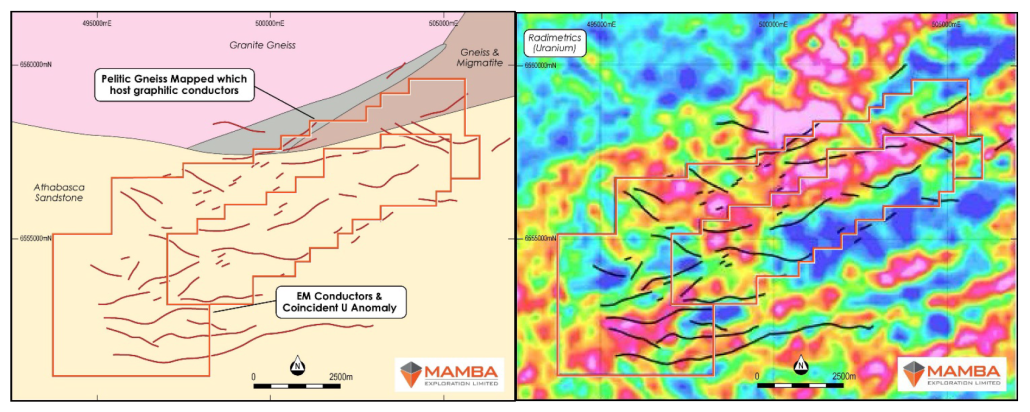
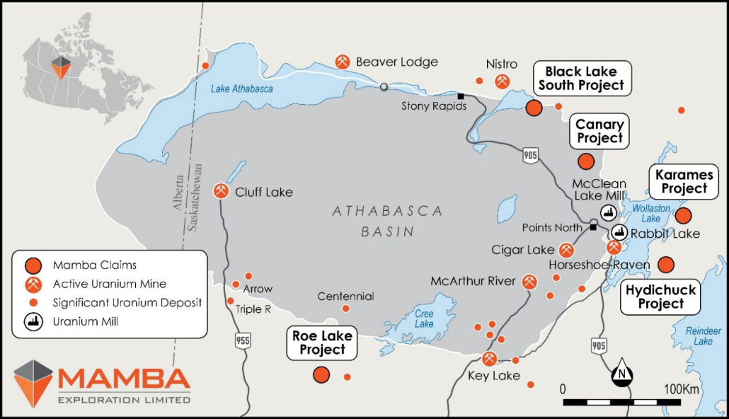
The Northern Athabasca Black Lake South Project spans an area of 49.4 sq km and features a classic unconformity uranium deposit model, akin to the one observed at Key Lake, with deposits located at shallow depths. Numerous electromagnetic (EM) anomalies have been identified, believed to be bedrock graphitic conductors crucial for the genesis of unconformity-style uranium deposits. These conductors coincide with robust uranium radiometric anomalies, further bolstering the validity of the target model. Significantly, these conductors are closely associated with a pelitic biotite-amphibole gneiss unit known to harbor graphitic horizons pivotal for deposit formation.

Figure 1: Location Map of Black Lake Project

Figure 2: Airborne radiometric uranium (left) and interpreted bedrock geology (right). Saskatchewan government compilation EM anomalies shown as black or red lines

Further Details –  🔗ASX Announcement:  Additional Acreage Acquisition, Athabasca Basin Uranium District, Saskatchewan, Canada

FOLLOW US

Location

Level 2, 25 Richardson St, West Perth WA 6005

Mailing List

© Mamba Exploration Ltd - Website by Web and Print Design
  • Home
  • Corporate
  • Projects
  • Investors
  • Contact
Scroll to top Scroll to top Scroll to top